Note: this blog has been migrated to Medium, with the articles here available to preserve permalinks Please see this post at https://medium.com/@ianrbuck/yellowstone-38d83e77a497
I have wanted to go to Yellowstone National Park for at least 15 years. In my mind as a child, Yellowstone represented the ultimate camping experience. Two summers ago my family tried to go, but we only made it to Mount Rushmore before our van made it clear that it was not going to make it over the Rocky Mountains.
This year, with a shiny new van, we made it.
Ironically before we even left Minnesota we blew out a tire.


This threw off our plans to go see Devil's Tower on our way to Yellowstone, but we vowed to stop there on our way home.
+scott kopp graciously let me borrow his DSLR camera, so I took lots of pictures. The full album is here, but a lot of the pictures will be in this post as well.
Any time that you go on a road trip out west, your first view of mountains up close is always the coolest thing you have ever seen. +Amy Buck and +Jonas Buck were both pretty terrified during that first mountain road.


We went to the south area of Yellowstone first and camped near Lewis Lake. It was really chilly, especially since we were used to the summer heat. +Caleb Buck, Jonas, and I huddled in our tent and played Magic the Gathering for most of the evening. I froze my butt off that night because I took my jeans off.


Total distance: 9.53 km (5.9 mi)
Total time: 2:28:46
Moving time: 1:58:11
Average speed: 3.85 km/h (2.4 mi/h)
Average moving speed: 4.84 km/h (3.0 mi/h)
Max speed: 8.91 km/h (5.5 mi/h)
Max elevation: 2430 m (7974 ft)
Min elevation: 2366 m (7764 ft)
Elevation gain: 150 m (493 ft)




Total time: 2:28:46
Moving time: 1:58:11
Average speed: 3.85 km/h (2.4 mi/h)
Average moving speed: 4.84 km/h (3.0 mi/h)
Max speed: 8.91 km/h (5.5 mi/h)
Max elevation: 2430 m (7974 ft)
Min elevation: 2366 m (7764 ft)
Elevation gain: 150 m (493 ft)






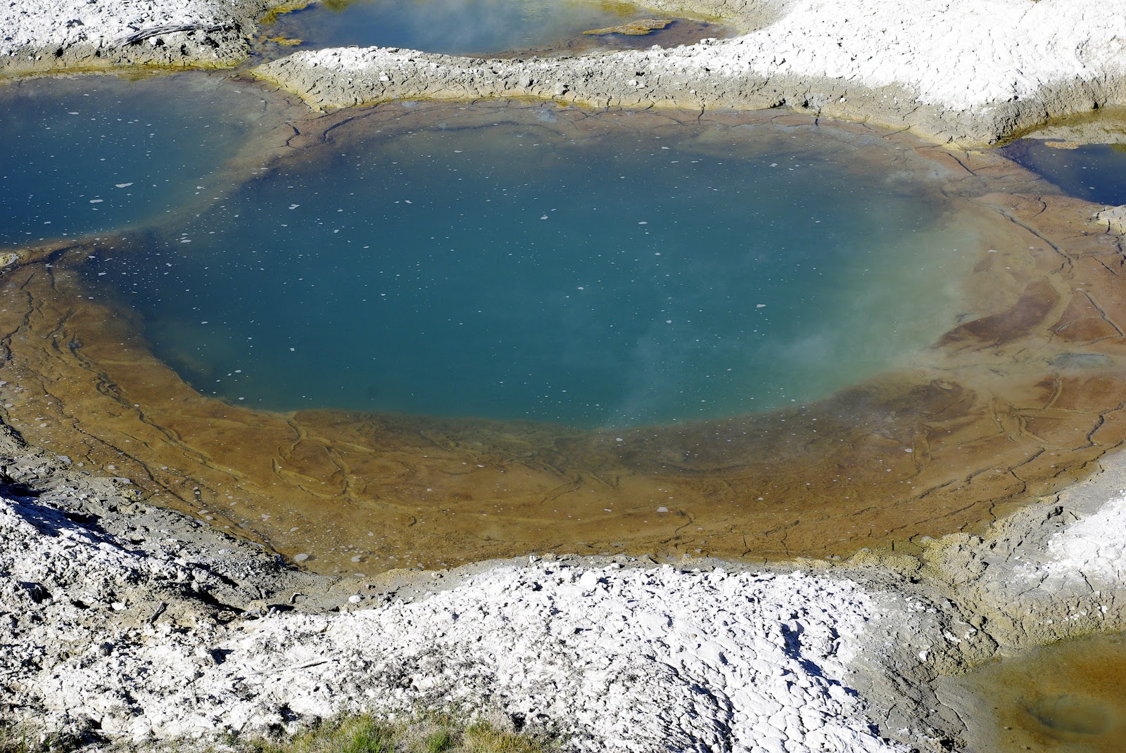
That afternoon the girls took us to see the hot springs, which was really cool. Yellowstone has a lot of crazy geological magic going on, and Jonas really enjoyed reading through the little pamphlets explaining exactly what was going on.




We also went to see Old Faithful, and I saw a few people there with cameras that gave me serious lens envy. I took a bunch of pictures, most of which turned out well.


The next day we got caught in a parking lot while a herd of bison ambled through, which was really cool. Most of them looked like they were in the middle of shedding their winter coats (they were rubbing themselves against a lot of trees) and there were quite a few calves.


We also saw some elk.


Yellowstone also has a "Grand Canyon" of its own, looking like something straight out of a painting. And there was a guy there who was painting it.


Then it was time to head up to Belgrade, Montana to visit mom's high school friend Karen. I got to drive because mom and dad were both exhausted from the last few days. Of course, it wasn't until we got there that I remembered that I had left my driver's license at home.

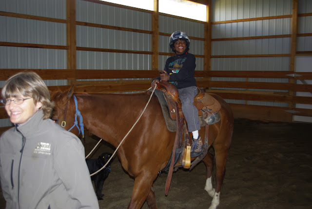
The Hoffmans train horses, so Tanushri and Subashri helped feed them and got to ride them.




Caleb and I ended up with the job of leading the horses because we're young and spry and can run as fast as the girls want the horses to go. It's a good thing that the horses weren't stubborn as the burros I raced in Philmont.




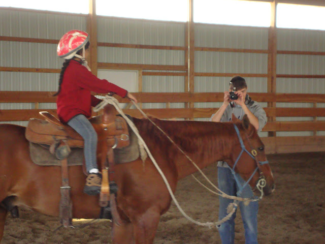


Caleb also got in on the horse riding action, and he almost ran into a wall. It was hilarious.


They also groomed the horses a bit and we got to watch Mike putting on new horseshoes.


We were also introduced to such classy pastimes as cribbage and golf. Caleb and I are pretty good at cribbage, but I don't think any of us can golf.


It rained for a while during dinner (fantastic smoked ribs!) and we got to see a double rainbow. What could it mean??


There was a full moon out that night, and the view of Belgrade was awesome, so I experimented with some long-exposure shots of the city and mountains surrounding the valley.


The exposure times range from 4 to 10 seconds, and they pick up a lot of detail that I myself couldn't see. I particularly like what happens when you use Picasa's automatic color corrector on some of the pictures:


The next day we left Tanushri and Subashri with Karen while the rest of us went on a hike to Lava Lake. I once again recorded our route.


The next day we got caught in a parking lot while a herd of bison ambled through, which was really cool. Most of them looked like they were in the middle of shedding their winter coats (they were rubbing themselves against a lot of trees) and there were quite a few calves.


We also saw some elk.


Yellowstone also has a "Grand Canyon" of its own, looking like something straight out of a painting. And there was a guy there who was painting it.


Then it was time to head up to Belgrade, Montana to visit mom's high school friend Karen. I got to drive because mom and dad were both exhausted from the last few days. Of course, it wasn't until we got there that I remembered that I had left my driver's license at home.

The Hoffmans train horses, so Tanushri and Subashri helped feed them and got to ride them.




Caleb and I ended up with the job of leading the horses because we're young and spry and can run as fast as the girls want the horses to go. It's a good thing that the horses weren't stubborn as the burros I raced in Philmont.


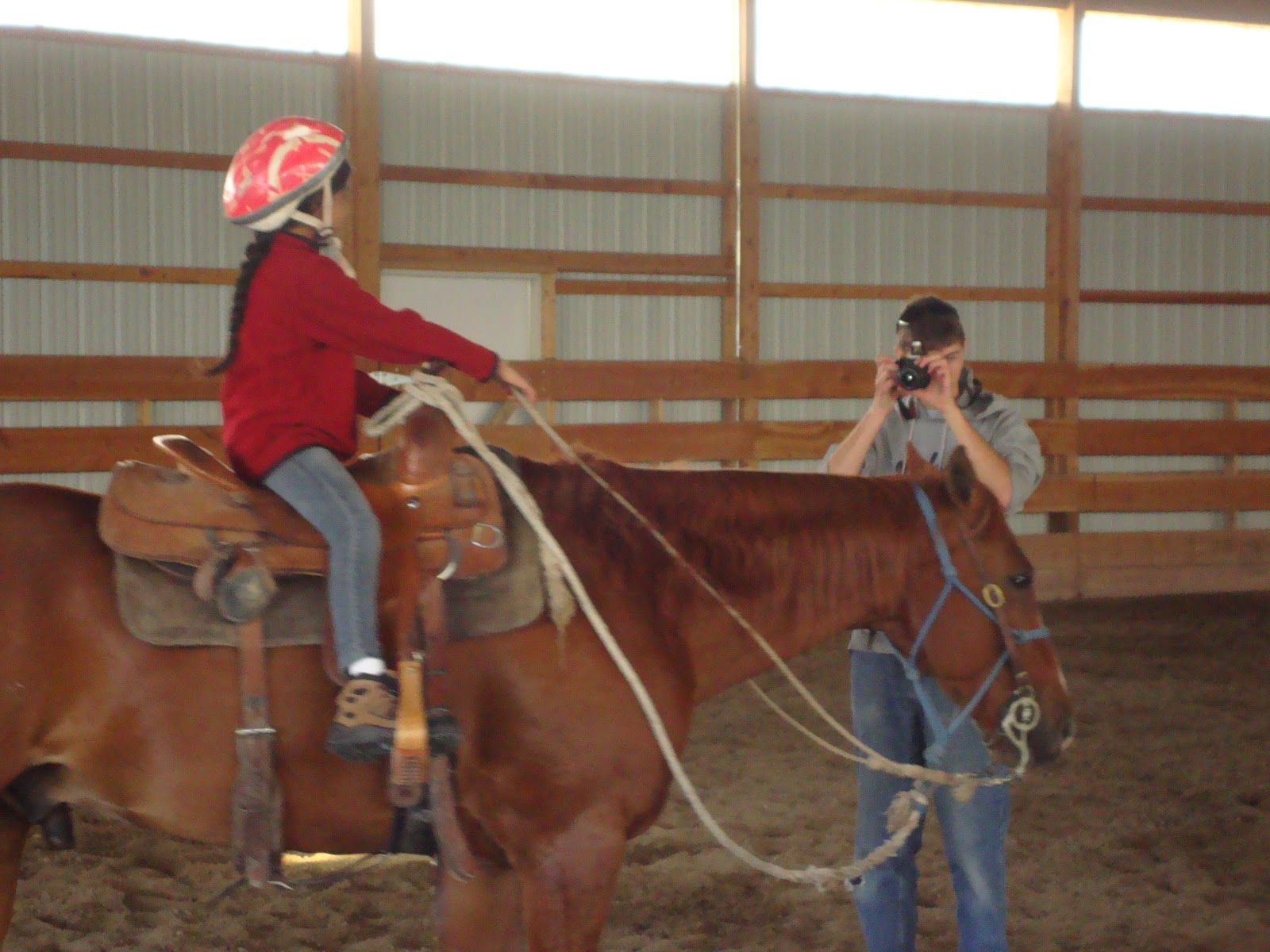


Caleb also got in on the horse riding action, and he almost ran into a wall. It was hilarious.


They also groomed the horses a bit and we got to watch Mike putting on new horseshoes.


We were also introduced to such classy pastimes as cribbage and golf. Caleb and I are pretty good at cribbage, but I don't think any of us can golf.


It rained for a while during dinner (fantastic smoked ribs!) and we got to see a double rainbow. What could it mean??


There was a full moon out that night, and the view of Belgrade was awesome, so I experimented with some long-exposure shots of the city and mountains surrounding the valley.


The exposure times range from 4 to 10 seconds, and they pick up a lot of detail that I myself couldn't see. I particularly like what happens when you use Picasa's automatic color corrector on some of the pictures:


The next day we left Tanushri and Subashri with Karen while the rest of us went on a hike to Lava Lake. I once again recorded our route.
Total distance: 10.17 km (6.3 mi)
Total time: 3:11:35
Moving time: 2:21:20
Average speed: 3.18 km/h (2.0 mi/h)
Average moving speed: 4.32 km/h (2.7 mi/h)
Max speed: 5.85 km/h (3.6 mi/h)
Max elevation: 2166 m (7106 ft)
Min elevation: 1653 m (5423 ft)
Elevation gain: 548 m (1798 ft)
The hike was pretty much all uphill on the way to the lake. It also seemed to be a pretty popular route among the locals because we saw plenty of people who were there with their dog or their family or their girlfriend, out for a nice picnic at the lake.
Total time: 3:11:35
Moving time: 2:21:20
Average speed: 3.18 km/h (2.0 mi/h)
Average moving speed: 4.32 km/h (2.7 mi/h)
Max speed: 5.85 km/h (3.6 mi/h)
Max elevation: 2166 m (7106 ft)
Min elevation: 1653 m (5423 ft)
Elevation gain: 548 m (1798 ft)
The hike was pretty much all uphill on the way to the lake. It also seemed to be a pretty popular route among the locals because we saw plenty of people who were there with their dog or their family or their girlfriend, out for a nice picnic at the lake.


I wanted to test out Google+'s new "auto-awesome" features, so I made sure to take some panoramic shots. I think it did an excellent job stitching them together.


Then it was time to check out the north part of Yellowstone. While the rest of the family went to find a camp site, dad, Caleb, and I hiked over Mt Washburn. Because of the elevation change on that hike, we were expecting it to be very challenging. However, the path was more of a gravel road the whole way, so it was actually a lot easier than Lava Lake.
Total distance: 10.43 km (6.5 mi)
Total time: 2:45:01
Moving time: 2:34:04
Average speed: 3.79 km/h (2.4 mi/h)
Average moving speed: 4.06 km/h (2.5 mi/h)
Max speed: 5.65 km/h (3.5 mi/h)
Max elevation: 3116 m (10224 ft)
Min elevation: 2656 m (8713 ft)
Elevation gain: 452 m (1483 ft)


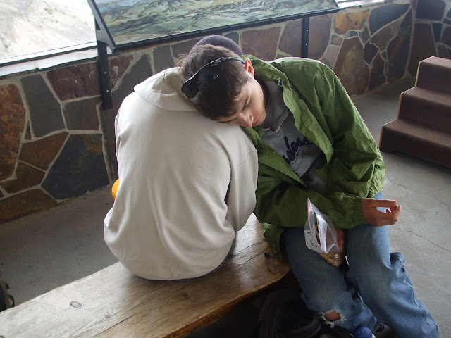


We camped near Mammoth Hot Springs, which is a huge tourist area near the north entrance to the park. We went to a gift shop and bought some shirts and got some ice cream. That was nice considering we had been camping for a while.
On our way out of the park we took a picture by the sign and the original arch that was built for the park.


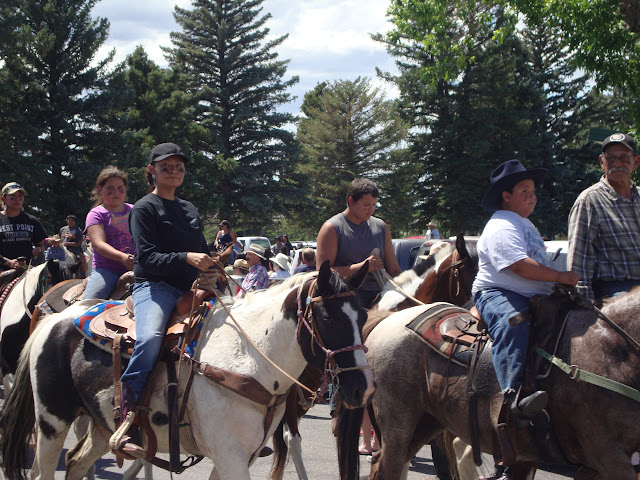
On the way home mom and dad decided to stop at Little Big Horn National Monument. To our surprise, it was free admittance and there were tons of people there. Turns out we showed up on the anniversary of the battle (June 25). I think that is the craziest coincidence I have ever experienced in my life. There were riders and runners from the Cherokee and Souix nations celebrating with a parade, and it was pretty cool.




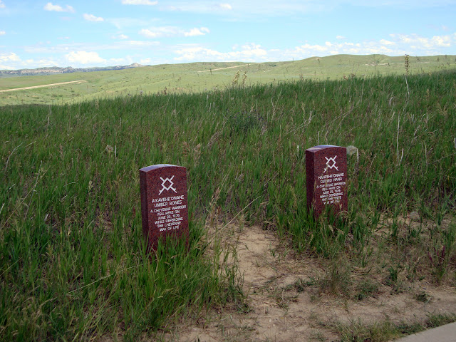
We walked around to all of the monuments and grave markers, which was sobering. The markers were placed where the men fell, so of course there is a large cluster at the site of the last stand.


Tanushri and Subashri once again did the Junior Ranger program. The ranger who swore them in added a line to the oath about the Little Bighorn Monument being the coolest national park in the country.


By evening we made it to Devil's Tower, which is so far out of the way that I guarantee you wouldn't find it unless you knew where it was. While we were hiking up to it we saw a few black widow spiders and a rattlesnake that Tanushri startled. Luckily everyone stayed calm and it went down a hole. So that was officially the deadliest hike I have ever been on.


Tanushri and Subashri didn't want to hike all the way back to take down camp, so I stayed with them at the visitor center and helped them with the Junior Ranger book while the rest of the family went back. The funny thing is that I learned more about Devil's tower from the Junior Ranger book than I did from the informational signs on the path around the tower. For example, most native cultures from the area called it "Bear Lodge" or something similar, which I think sounds way cooler than "Devil's Tower".

The ranger who gave them their badges told me he liked my shirt, and I'm not sure if that means that he went to Morris and lived in Gay Hall or if he is gay. Come to think of it, he had really good handwriting (not to proliferate stereotypes or anything.)
On our way around the tower we saw a couple of climbers making their way up it, as well as the stake ladder used by the first two people to make it to the top back in the late 19th century.


I of course recorded our trek.
Total time: 2:45:01
Moving time: 2:34:04
Average speed: 3.79 km/h (2.4 mi/h)
Average moving speed: 4.06 km/h (2.5 mi/h)
Max speed: 5.65 km/h (3.5 mi/h)
Max elevation: 3116 m (10224 ft)
Min elevation: 2656 m (8713 ft)
Elevation gain: 452 m (1483 ft)


At the top was a fire lookout station with a nice room with paintings that labeled what you were looking at off in the distance. Unfortunately, the building prevented me from taking a full 360 degree panorama. But what can you do?


We camped near Mammoth Hot Springs, which is a huge tourist area near the north entrance to the park. We went to a gift shop and bought some shirts and got some ice cream. That was nice considering we had been camping for a while.
On our way out of the park we took a picture by the sign and the original arch that was built for the park.


On the way home mom and dad decided to stop at Little Big Horn National Monument. To our surprise, it was free admittance and there were tons of people there. Turns out we showed up on the anniversary of the battle (June 25). I think that is the craziest coincidence I have ever experienced in my life. There were riders and runners from the Cherokee and Souix nations celebrating with a parade, and it was pretty cool.


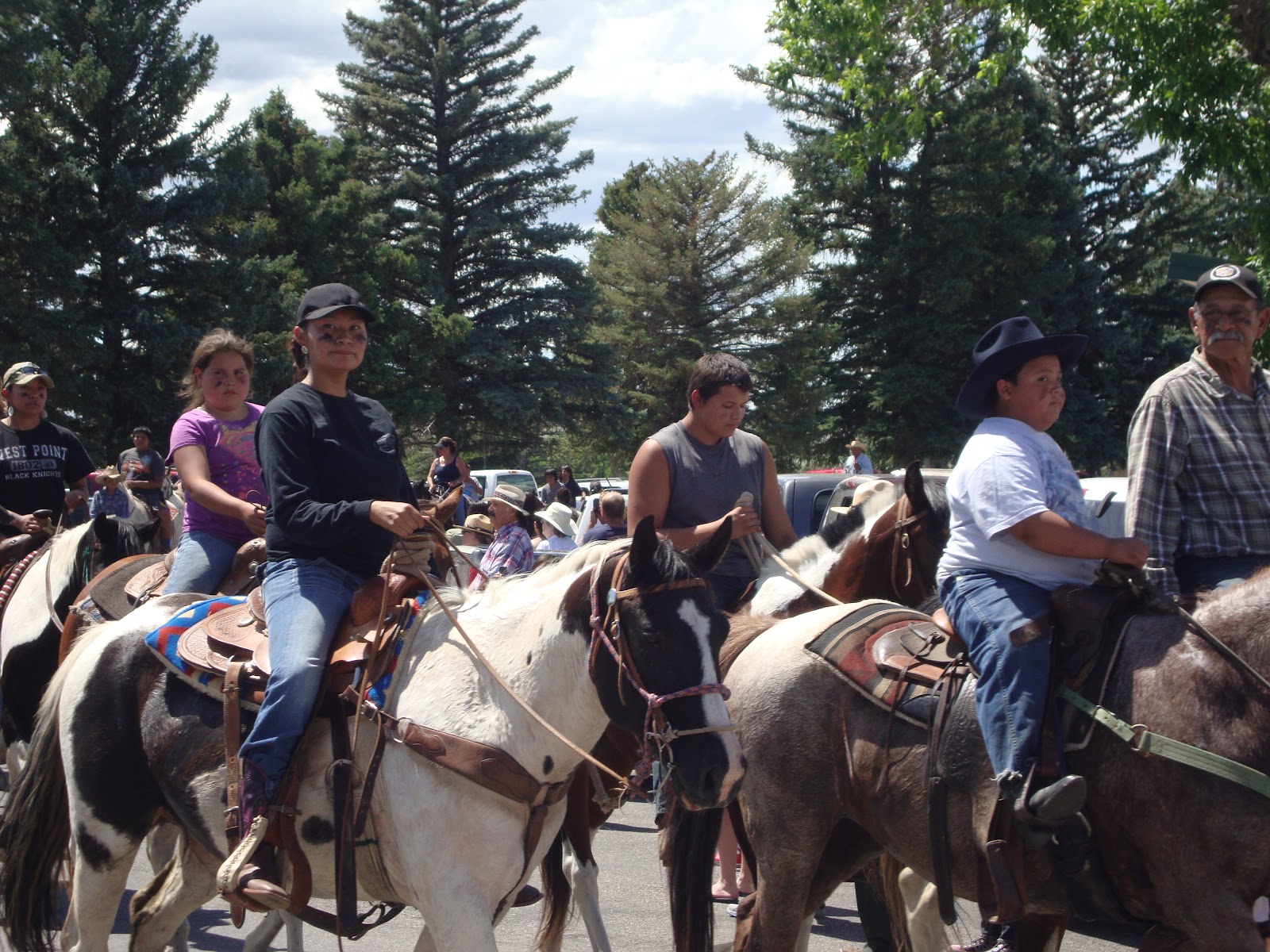


We walked around to all of the monuments and grave markers, which was sobering. The markers were placed where the men fell, so of course there is a large cluster at the site of the last stand.


Tanushri and Subashri once again did the Junior Ranger program. The ranger who swore them in added a line to the oath about the Little Bighorn Monument being the coolest national park in the country.


By evening we made it to Devil's Tower, which is so far out of the way that I guarantee you wouldn't find it unless you knew where it was. While we were hiking up to it we saw a few black widow spiders and a rattlesnake that Tanushri startled. Luckily everyone stayed calm and it went down a hole. So that was officially the deadliest hike I have ever been on.


Tanushri and Subashri didn't want to hike all the way back to take down camp, so I stayed with them at the visitor center and helped them with the Junior Ranger book while the rest of the family went back. The funny thing is that I learned more about Devil's tower from the Junior Ranger book than I did from the informational signs on the path around the tower. For example, most native cultures from the area called it "Bear Lodge" or something similar, which I think sounds way cooler than "Devil's Tower".

The ranger who gave them their badges told me he liked my shirt, and I'm not sure if that means that he went to Morris and lived in Gay Hall or if he is gay. Come to think of it, he had really good handwriting (not to proliferate stereotypes or anything.)
On our way around the tower we saw a couple of climbers making their way up it, as well as the stake ladder used by the first two people to make it to the top back in the late 19th century.


I of course recorded our trek.
Total distance: 5.48 km (3.4 mi)
Total time: 2:00:03
Moving time: 1:26:40
Average speed: 2.74 km/h (1.7 mi/h)
Average moving speed: 3.79 km/h (2.4 mi/h)
Max speed: 5.96 km/h (3.7 mi/h)
Max elevation: 1322 m (4339 ft)
Min elevation: 1159 m (3803 ft)
Elevation gain: 204 m (668 ft)
For our last night we splurged and stayed at a KOA. I know, it's not real camping. Seriously, they had a pool and wifi. We weren't complaining.


Over the course of the car rides I listened to a ton of podcasts and read Star Wars: Scoundrels and its companion novella Winner Lose All both by Timothy Zahn. I'm sure I'll be telling you all about them soon enough.
Total time: 2:00:03
Moving time: 1:26:40
Average speed: 2.74 km/h (1.7 mi/h)
Average moving speed: 3.79 km/h (2.4 mi/h)
Max speed: 5.96 km/h (3.7 mi/h)
Max elevation: 1322 m (4339 ft)
Min elevation: 1159 m (3803 ft)
Elevation gain: 204 m (668 ft)
For our last night we splurged and stayed at a KOA. I know, it's not real camping. Seriously, they had a pool and wifi. We weren't complaining.


Over the course of the car rides I listened to a ton of podcasts and read Star Wars: Scoundrels and its companion novella Winner Lose All both by Timothy Zahn. I'm sure I'll be telling you all about them soon enough.


